Geomarketing and catchment area
Analyze your data and conduct comprehensive geo-marketing studies with a collaborative, easy-to-use solution tailored to your business. Maps, as true communication tools, help you to make the best decisions, understand your territorial grid, and efficiently develop your network of sales outlets, agencies, sites…
Analyzing your catchment areas : what is it for?
Nomadia Sales & Marketing helps companies study, understand and exploit their sales potential to the full. Developed for network development, sales, marketing and communication professionals, this go-to geo-marketing software combines all the necessary features for the spatial and statistical analysis of geographical, sales and marketing data.
If you want to calculate a catchment area, find the best sites for your stores, carry out a market study, identify your priority prospecting areas, estimate the potential turnover of a future sales outlet, or test a new sales strategy, Nomadia Sales & Marketing is for you!

The main features of Nomadia Sales & Marketing
An all-in-one geo-marketing solution tailored to your business
- Import formats: XLSX, ODS, KML, MDB, WFS, MNT, SRTM HGT...;
- Databases: Oracle, SQL Server, PostGreSQL/PostGIS, MySQL...;
- Web services: Microsoft Bing, IGN Geoportail, Google Street View, OpenStreetMap...
- unitary geocoding, mass geocoding, reverse geocoding;
- house number, street, district, town level geocoding...;
- interactive error processing, address standardization;
- French and foreign nomenclature manager.

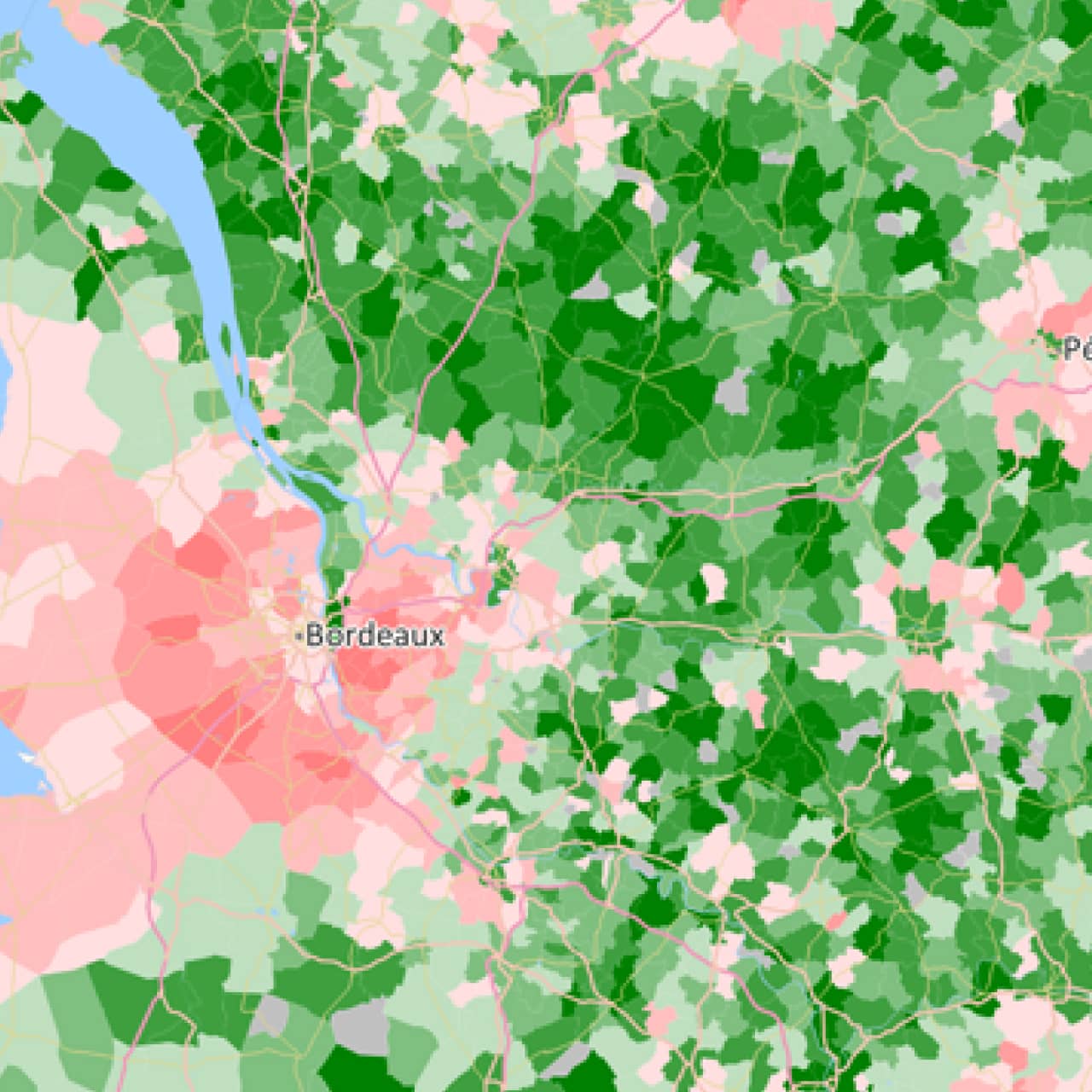
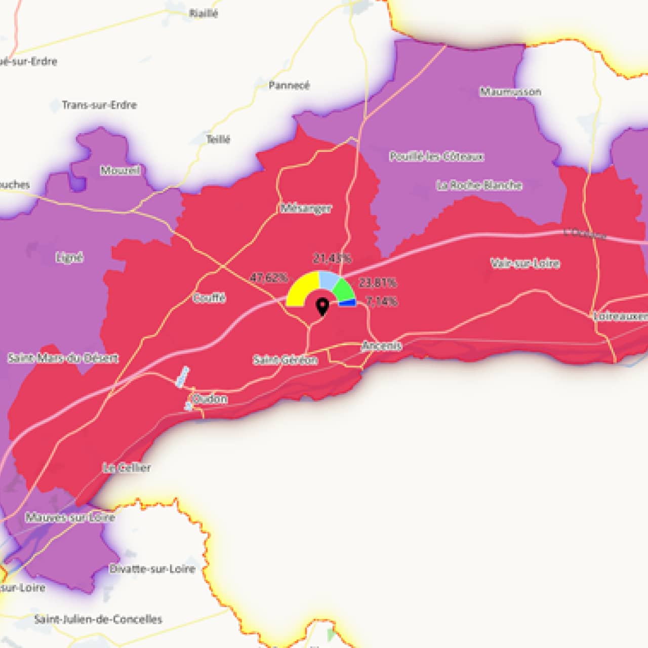
- statistical analyses: colour gradients, symbols, pie charts…;
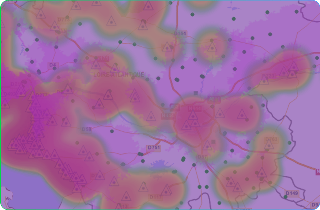
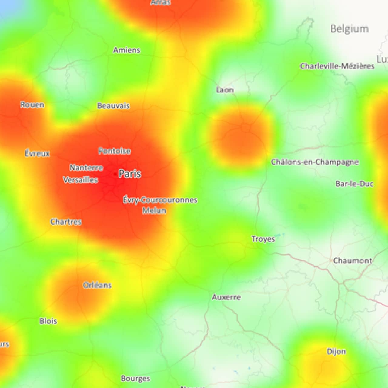
- complex representations: aggregates, heat maps, flow maps...;
- intelligent display of items, personalization of legends;
- design and processing of 3D and 4D data.
- spatial analysis: buffer zone, equidistant sector, topological and attribute junction, specific grid, coverage curve…;
- accessibility analysis: isochrone and isodistance zones, distance tables, route calculation, barycenters, search around function…

- improved customer knowledge;
- calculation of targeting areas;
- geo-merchandising and tailoring of the offering.
- predictive analysis: coverage curve, impact study and simulation;
- Huff and MCI probabilistic gravitational attraction models;
- segmentation and customer typologies.
- multi-criteria territory management: equidistant sectors, from a pattern of points, affiliation with hubs, combination of surface entities…
- optimizing constraint-based routes: route plans, customizable road graphs, traffic models…
- shared cartographic reference table;
- centralization of data and map-user components;
- management of users and groups of users;
- data dissemination by reference table subscription system.

- integrated report generator: maps, graphs, tables… ;
- online publication of maps and studies;
- creation of geographical applications and web portals;
- integration of geo-optimisation APIs.
Zooming in on catchment areas
The different types of catchment area and their uses
Click on the thumbnails below to find out more about each type of area.
![]()
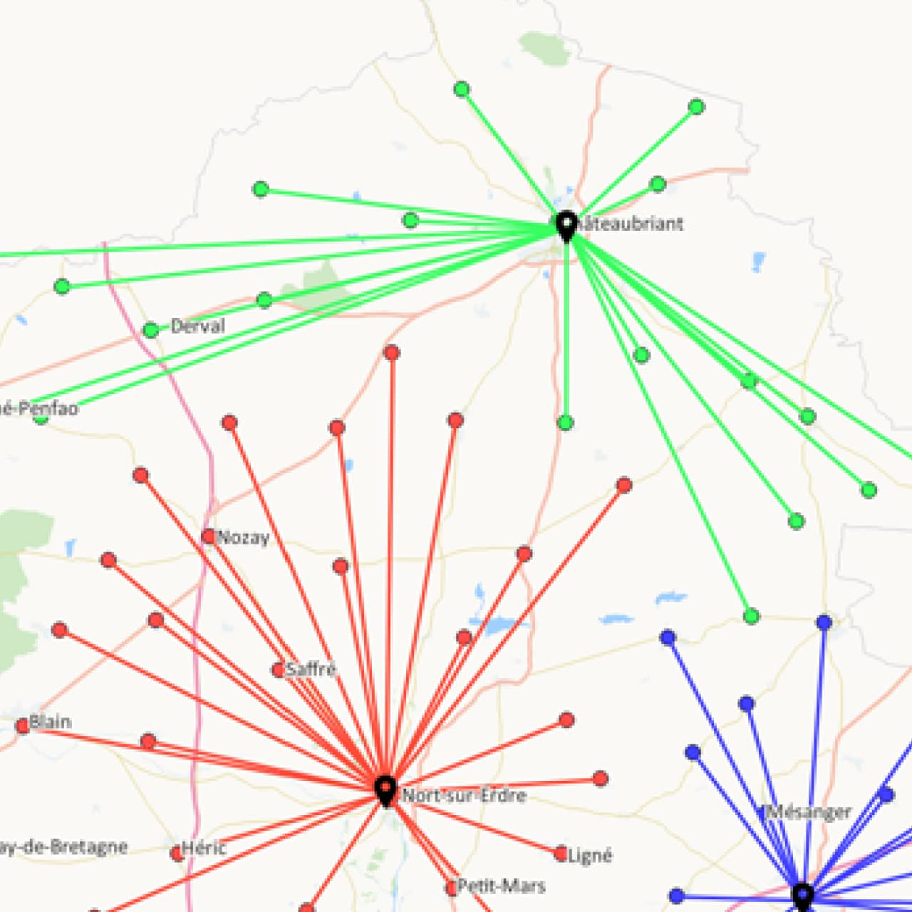
Convex area
Defined “as the crow flies” around a sales outlet and comprises all the customers assigned to it.
![]()
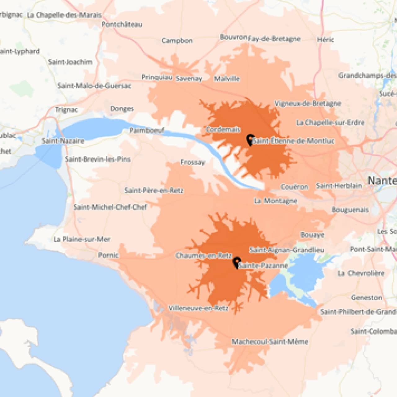
Isochrone and isodistance area
Represents the areas accessible within a defined time or distance around a sales outlet, an agency, a site, and enable its potential customer base to be measured.
![]()
Customer area
Calculated from the customer database and enabled an accurate analysis of where the real customer base comes from.
![]()
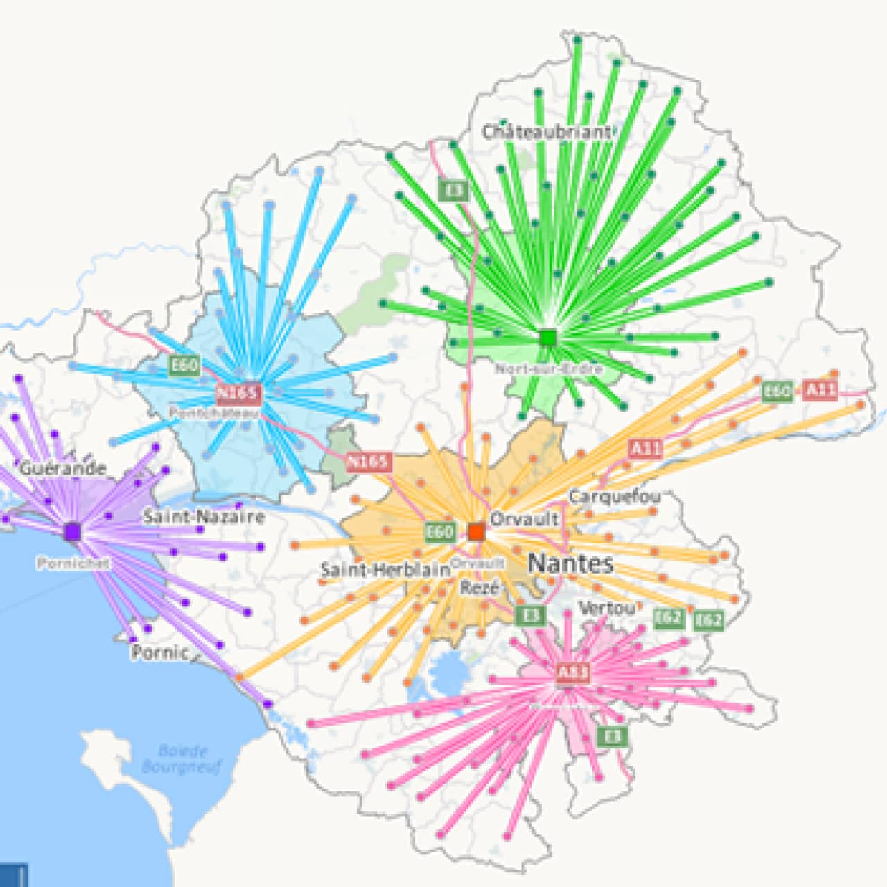
Targeting area
An optimized area for direct marketing activities, in relation to a clearly defined target to be achieved.
![]()
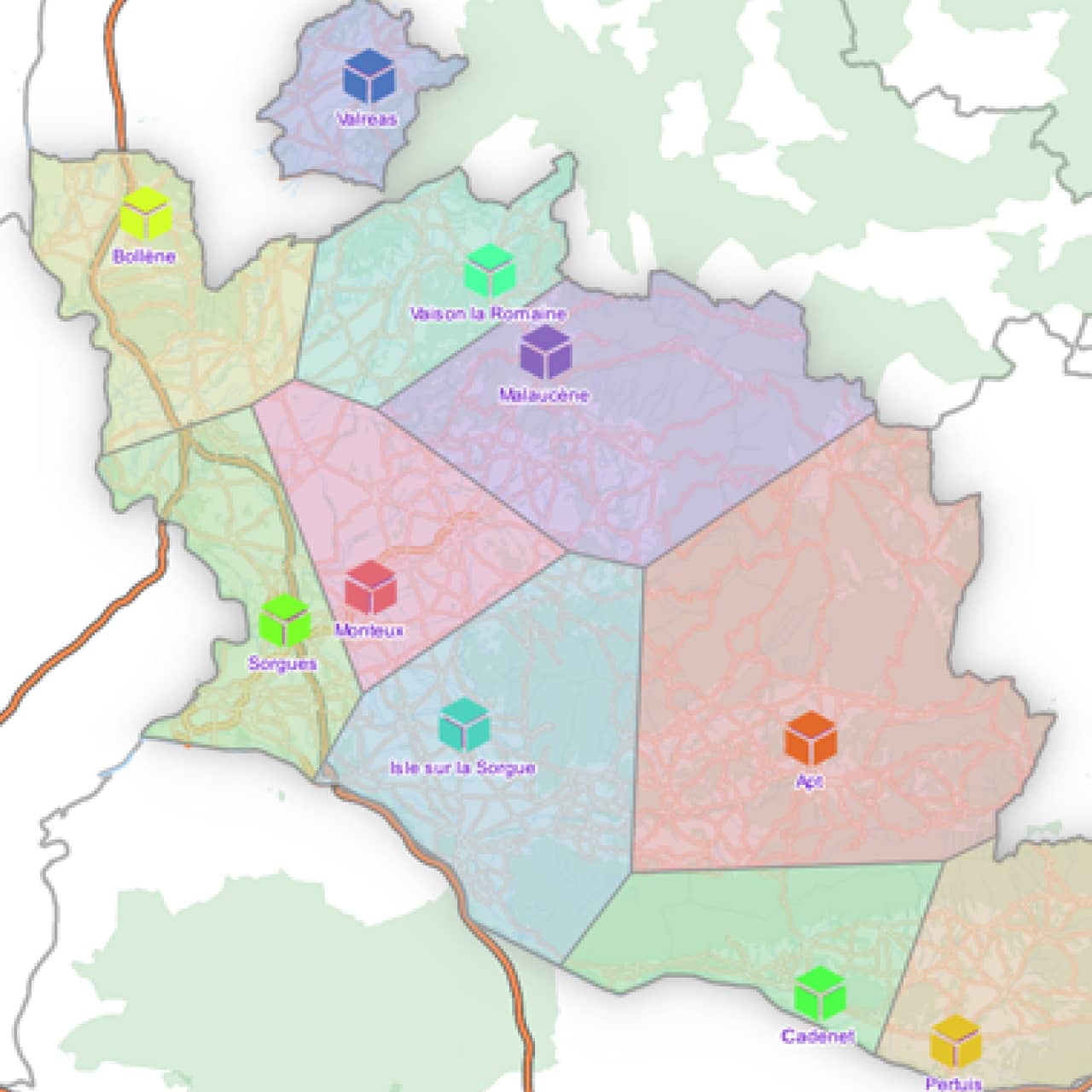
Theoretical attraction area
Helps evaluate the attractiveness of sales outlets by taking account of the presence of competitors.
Request a personalized demonstration or a quote
Want to learn about our prices, receive a personalized demonstration of Territory Manager, or request a specific quote? Enter your contact information below, and our experts will get back to you as soon as possible.
Any further questions?
You’ll find the answers to our customers’ most frequently asked questions here.
Nomadia is the leading French publisher of SaaS Smart Mobility solutions, guiding more than 175,000 professionals in the field every day. Our solutions are easy to use and quick to roll out, and they guarantee a significant, immediate return on investment.
Combining the expertise of a software integrator / editor with that of a consulting firm, Nomadia’s teams provide you with customized support, from data consulting to the roll-out of mobile terminals. Moreover, our technical support is available 24 hours a day, seven days a week.
Nomadia solutions guide the digital transformation of all types of mobile professionals: traveling sales representatives, delivery drivers, technicians, auditors, healthcare personnel, diagnosticians, service providers, patrolmen, experts, and more.
From small- and medium-sized companies to large corporations, our solutions can be adapted to companies of any size and in any sector.
Each Nomadia solution consists of a ready-to-use SaaS which includes a back office and a mobile business application specially designed for field operations.
Our APIs and their many connectors allow you to integrate our technologies into third-party applications, whether those are custom solutions or market standards.
Our consultant teams can also help you set up a customized solution that is perfectly adapted to your business processes.
Yes! Contact our team to get an evaluation version of the solution of your choice.
As a company committed to the planet, Nomadia naturally asserts a strong CSR (Corporate Social Responsibility) approach. We integrate social, ecological and economic issues into everything we do.
By optimizing the mobility of mobile professionals, our solutions help improve our customers’ productivity, the well-being of their employees, and the impact of their businesses on the environment.
The Nomadia teams are available to answer all your questions:
- via our online form
- by phone at +91 4443156075