Geography: the ally of choice for your mobile teams…
In every company, the activities of a mobile sales team can be broken down into four phases: mobile field forces organization, appointment scheduling, route management and efficiency analysis.

While each of these phases is linked to specific actors, time constraints, tasks and actions, they also have one key point in common: geography. This is often made light of, or perceived as a constraint that has to be borne rather than exploited, but on the contrary, the geographic dimension can – when judiciously exploited – be used as a driver for rationalising and optimizing the administration and operation of a mobile sales force.
Here are approaches and tools you can mobilize during each phase to take the geographic dimension into account so it becomes your greatest ally.
Administrating sales: sectorization has a key role
Sectorization is the cornerstone of structuring the activities of a mobile sales team. Defining and assigning balanced territories to individual sales staff – in terms of sales potential, the number of customers or prospects to visit, visit locations and travel capability – will condition the operational efficiency of sales staff, and importantly (a point that is often overlooked) their commitment in the medium to long-term to the role.
Geomarketing solutions allow you to study potential for a geographic area: you can assess current performance and set up the required sectorization and organisation so the whole of the market is efficiently covered. Automated sectorization tools featuring notions of balancing potential, travel time between customers/prospects, sales history, or even proximity of zones in relation to each other, allow you to establish an optimized sales map that is fit for purpose in relation to available resources.
Scheduling: you can do more, thanks to geoptimization
Whether or not the responsibility for scheduling falls to the planning team and sales staff themselves, scheduling aims to design a rational programme of visits that is practicable: both rational and realistic. Geoptimization systematically exploits the geographic dimension to maximise productive time with customers/prospects (number and duration of visits) while minimising travel times and distances.
Geoschedulling systems provide efficient handling for appointment making and calculate optimized route plans dynamically, factoring in geographic parameters, customer criteria and key sales strategy factors.
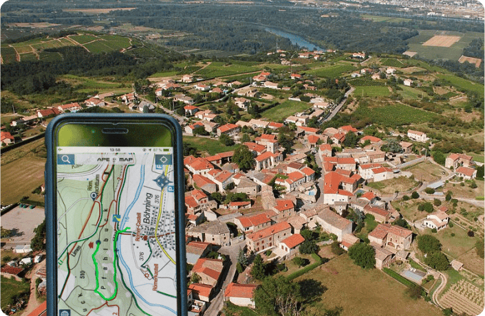
Operations management: more proactive thanks to mobile tools
On the ground, having access to information about visits and routes, and real-time travel constraints thanks to tracking tools, are logical extensions to the basic organisation and scheduling operations. They guarantee teams can respond at pace and be proactive in communicating with customers in the event of a late arrival or cancellation.
With or without tracking components, mobile help systems provide sales personnel with the necessary support for managing the geographic dimension of their routes: direction of travel, dynamic re-routing, search for customers/prospects nearby…
Monitoring and analysis: developing potential using geo-reporting
The task of tracking and analysing visit plans essentially falls to sales managers, who can rapidly discover avenues for improvement using Geo-reporting or Business Intelligence geographic systems: these will automatically generate and consolidate the reports needed for a detailed analysis of activities and performances for sales staff operating on each sector, area or zone grouping.
By analysing the way operations unfold on the ground as compared with the way they were originally planned, sales managers can identify problem areas for sectors and routes and define adjustments to apply to the process to help their teams realise the potential offered by their sales territory.
Each phase of your operation can obviously be optimized independently of the others using dedicated geographic tools that are apt for that part of the process. However, only a global approach that articulates these various component tools will fully harness the geography and make it work for you, translating geographic information into competitive advantage.